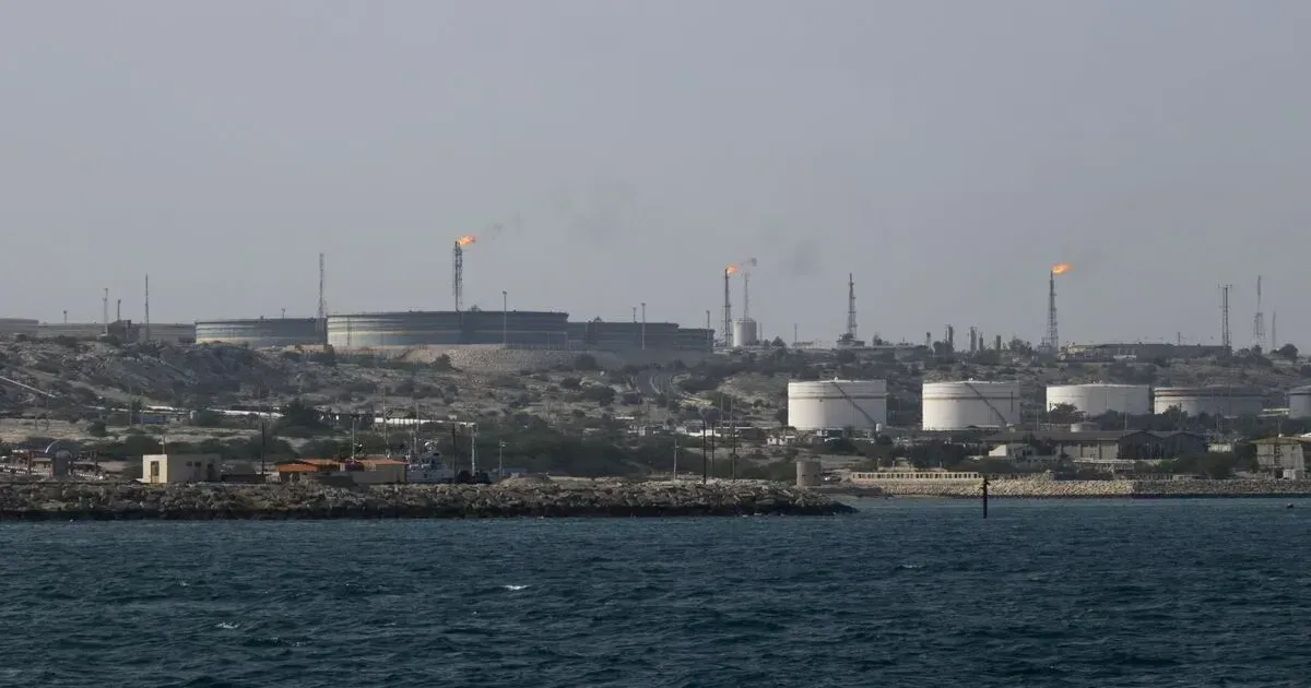
Satellite sensors orbiting high above the Persian Gulf recorded a scene of unexpected industrial activity on Saturday morning. Images transmitted back to Earth revealed two oil tankers securely berthed at the Kharg Island export terminal, a facility widely considered the crown jewel of the Iranian energy infrastructure. Analysts at TankerTrackers.com, a specialized firm that monitors global maritime traffic via satellite, first identified the ships and confirmed their presence at the loading docks. The satellite report showed tankers still berthed at Kharg Island despite nearby strikes, complicating the first read of Iran's export resilience. Data showed the tankers positioned at the facility despite the proximity of recent kinetic action. Kharg Island handles roughly 90 percent of the crude oil exported from the region, making it a focal point for global energy security. Any disruption here typically triggers immediate instability in the Brent crude markets. The physical infrastructure of the island appeared largely intact in the latest high-resolution optical passes. The berthing of these large vessels suggests that the technical personnel and maritime operators on the ground felt confident enough in the terminal's safety to proceed with loading operations. Ground crews and tugboat operators must coordinate precisely to dock ships of this size, implying that the command and control structures governing the port remained functional throughout the night. Maritime traffic patterns in the Persian Gulf often provide a more accurate picture of ground realities than official government statements. While the strikes focused on military hardware, the persistence of the oil trade is a data point for those measuring the resilience of the local economy. Intelligence agencies often monitor these docks to gauge the immediate impact of regional tension on export capacity. The presence of the ships indicates that the logistics of the oil trade were not paralyzed by the sound of explosions on the horizon.
Kharg Tankers Complicate Strike Story
Kharg Island features a large T-shaped jetty and a separate deep-water berth known as the Sea Island. These structures are built to withstand heavy weather and have been fortified over decades of regional friction. Port records indicate that the loading arms, which pump crude into the holds of tankers, can transfer millions of barrels in a single day. Satellite imagery provides a clear view of these loading arms extended toward the hulls of the two oil tankers now docked. This visual evidence contradicts early speculation that the entire island might have entered a state of total lockdown following the military engagement. Docking a tanker at Kharg is a complex maneuver involving specialized pilots who guide these behemoths through narrow approach lanes. the pilots were on duty and active in the hours following the strikes, pointing to a high level of operational readiness. the terminal functions as a central valve for the nation's primary source of hard currency. Keeping that valve open is a strategic priority that seemingly took precedence over any immediate security concerns regarding the nearby military sites. The speed at which the vessels were moored suggests that the port authorities had pre-cleared these movements well in advance of the strikes. Oil continues to flow.
Technical specifications for the T-jetty allow it to accommodate multiple tankers simultaneously, including Very Large Crude Carriers. Each of these ships can carry upwards of two million barrels of oil, representing a notable financial transaction for the exporting state. Meanwhile, the Sea Island berth on the western side of the island provides even deeper water access for the largest vessels in the global fleet. The military installations that were the actual targets of the US strikes are located at a distance from these primary loading zones, providing a buffer that protects the revenue-generating assets.
Satellite Data Calms Some Oil Fears
Specialists at TankerTrackers.com use a combination of optical imagery and Synthetic Aperture Radar to track vessels that have disabled their Automatic Identification System transponders. This technique, often called dark shipping, is a standard method for moving cargo in sensitive regions. But the two oil tankers spotted on Saturday were visible to standard optical satellites, suggesting they were not attempting to hide their location during the loading process. This transparency could be interpreted as a sign of confidence by the port operators. The clarity of the images allowed analysts to identify the particular class of vessels based on their deck configurations and length.
The presence of these tankers so soon after the strikes confirms that the export infrastructure at Kharg Island remains a functioning entity rather than a sidelined asset.
Observation of the docks also revealed activity around the storage tanks located on the interior of the island. These tanks hold the crude before it is pumped to the jetties. Monitoring the shadows cast by the floating lids of these tanks allows analysts to estimate the volume of oil stored on the island at any given time. Current data suggests that these storage levels remain high, providing a buffer against any temporary disruptions in the pipelines from the mainland. The logistics chain appears to have weathered the immediate shock of the military strikes without a severe failure in throughput.
Military analysts often look for secondary fires or smoke plumes in satellite imagery to assess battle damage. In this instance, the absence of smoke over the oil terminals confirmed that the US strikes were focused and did not stray into the energy sector. The distinction is essential for market participants who feared a broader assault on the regional energy hub. The tracking of these vessels will continue as they depart the island and move toward their eventual destinations, which are typically refineries in East Asia.
Hormuz Risk Keeps Premiums High
Traders in London and New York watched the satellite updates closely as the trading week drew to a close.
Market instability remains a constant threat when military action occurs near major shipping lanes. The Strait of Hormuz, located just downstream from Kharg, is the narrowest point through which one-fifth of the world's oil must pass. If the tankers at Kharg can complete their loading and successfully transit the strait, it proves that the maritime corridor remains viable. Even the cost of insurance for these vessels has risen sharply over the past forty-eight hours. Shipping companies must now factor in high war-risk premiums for any hull entering the northern gulf.
Satellite data does not lie. Evidence from the docks indicates that the demand for the crude remains strong enough to justify the risks. For instance, the tankers now at the island are likely operating under contracts that require them to move regardless of the geopolitical climate. The physical presence of the ships is a more reliable indicator of economic intent than any diplomatic language. A complete vacancy at the docks would have signaled a much more severe escalation in the conflict.
Oil Flows Still Define the Strike
The tanker images complicate the first read of the strike. If Kharg can still load crude while nearby military sites burn, markets may treat the attack as a warning shot rather than a full shutdown of Iranian exports.